University Transition
Falmouth & Penryn Community Map 2026: GPS & Accessibility Guide
A Falmouth and Penryn community map for finding everyday essentials, directions and campus accessibility information.
Moving to Falmouth University or Penryn this September? I created Moving to Falmouth Uni – Sept. 2026, a simple Google map with key places you might need in your first few days.
You do not need to learn Falmouth and Penryn all at once. Start with the essentials on your phone, then use the university’s full maps when you are ready for more.
For SEND, disabled and neurodivergent students, the map also includes dedicated accessibility layers for Falmouth and Penryn campuses, with direct links to AccessAble where available.
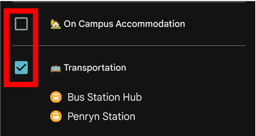
Want to see more or less markers? Tap the menu/filter icon  in the top-left corner of the map, then tick the categories you want to see and untick the ones you want to hide.
Open the Falmouth and Penryn community map
Looking for the official campus maps? This independent community map is a simpler companion for students moving around Falmouth and Penryn. For comprehensive campus information, use the FX Plus Interactive Map and Falmouth University PDF maps.
What’s on the Falmouth and Penryn community map?
The map focuses on places you are most likely to need during your first few days:
- on-campus food and drink;
- late-opening shops and useful essentials;
- buses, trains and transport;
- places to ask for help;
- health services; and
- Falmouth and Penryn campus accessibility information.
You can switch categories on and off, so you only see what is useful to you. The map intentionally does not try to show everything: it keeps the information smaller and easier to scan while you are moving around Falmouth and Penryn.
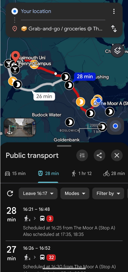
Because it uses Google Maps, you can also use your phone’s location services and Google Maps directions where supported.
Falmouth and Penryn Campus accessibility information
Relevant campus buildings link directly to their AccessAble accessibility guides where available.
Tap a building and you may be able to check information about entrances and outside access, lifts, accessible toilets, parking, routes around the building and other building-specific accessibility details.
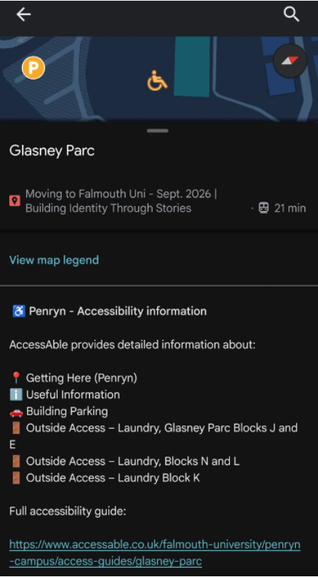
The map does not simply label an entire building as “accessible”. Different students need different information, so the AccessAble links let you check the details that matter to you before you visit.
How to use the map on your phone
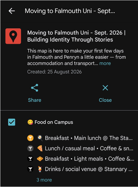
1. Open and filter the map
- Tap Open the Falmouth and Penryn community map on your phone.
- Depending on your device and settings, it may open in Google Maps or your browser. If possible, open it while signed in to your Google account.
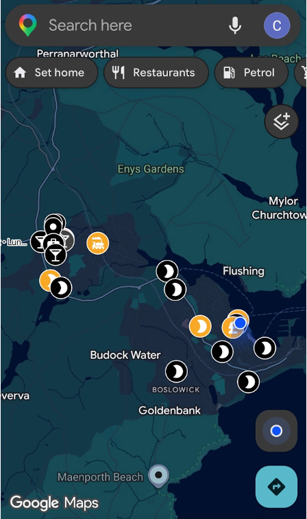
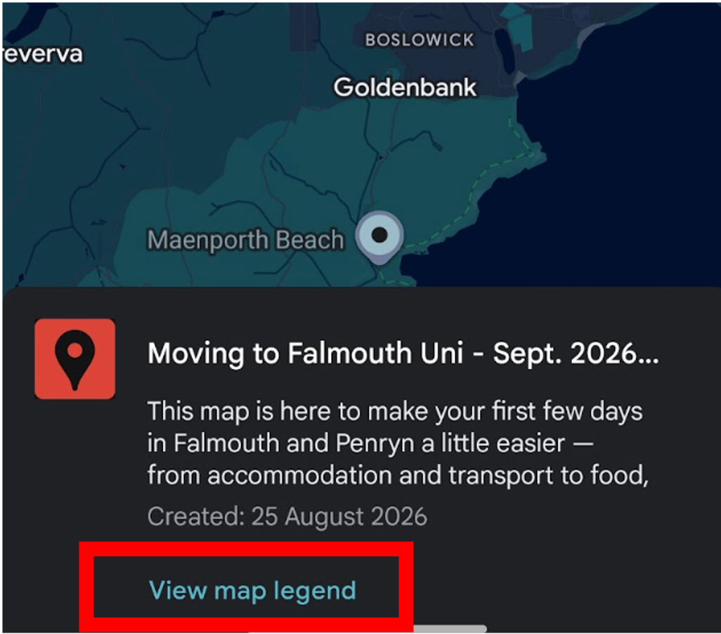
- Tap View map legend or the menu/filter icon in the top-left corner of the map.
- Tick the categories you want to see and untick the ones you want to hide.
2. Tap a place and check accessibility information
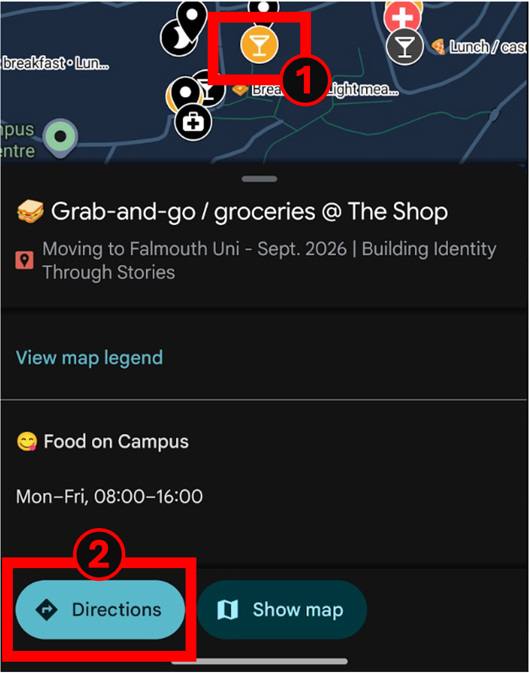
- Tap any marker to open its information.
- For relevant campus buildings, follow the linked AccessAble guide to check accessibility information before travelling or while you are nearby.
- Use the details that matter to you, rather than relying on a general “accessible” label.
3. Get directions and find the map again
- Tap a marker, then select Directions.
- Choose the travel option that works for you, such as walking, public transport, cycling or driving.
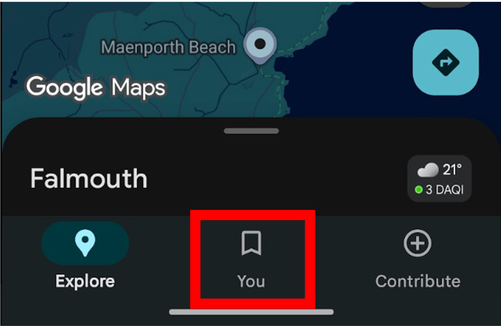
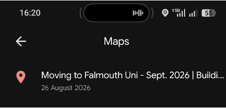
- If you opened the map while signed in, you may also be able to find it again under Google Maps → You/Saved → Maps.
- You can also bookmark the map link in your browser. You do not need to install the map as a separate app or file.
Important information about the map
This is an independent, informal guide for 2026, not an official Falmouth University or FX Plus map. It is designed to sit alongside official university, campus and accommodation information rather than replace it.
Accessibility information is linked from AccessAble where available. Follow the AccessAble link on an individual location for fuller and current accessibility information.
Information can change, so check the relevant official source when making important travel, accommodation or accessibility arrangements.
Spotted something missing or incorrect? Let me know so I can check the map.
Falmouth University map FAQs
Can I use the map with my phone’s GPS?
Where supported, you can use your phone’s location services and Google Maps navigation features to see where you are and get directions to places on the map.
How do I find accessibility information for a building?
Turn on Falmouth – Accessibility information or Penryn – Accessibility information, then tap the relevant building. Where available, its marker links directly to the AccessAble guide.
Is the map only for SEND, disabled or neurodivergent students?
No. Anyone moving to Falmouth or Penryn can use it. It has also been designed with accessibility in mind so students who need this information can find it more easily.
Is this an official Falmouth University map?
No. It is an independent 2026 community guide. For comprehensive official campus information, use the FX Plus and Falmouth University maps linked near the top of this page.
Save it for when you need it
You do not need to learn Falmouth and Penryn all at once. Save the map before you arrive, switch on the categories you need, and use it to find useful places, directions and accessibility information in one place.